Boundary Dispute Survey
Boundary Dispute Surveys with Expert Insight
Get a Free Quote From Us Today!
We aim to get back to you in 24 hours.
At Boundary Dispute Survey, we provide professional land measurement and reporting services designed to help resolve disagreements over property boundaries across the UK. Our specialist service focuses on gathering accurate evidence and producing detailed survey reports to support mediation or formal legal proceedings.
By reconciling physical on-site evidence with Land Registry documentation, our boundary dispute survey ensures that ownership limits are clearly defined, which reduces conflict and prevents the high costs associated with protracted legal litigation.
What Services Are Included in a Boundary Dispute Survey?
A comprehensive package provided by a boundary dispute survey incorporates a structured suite of investigative and technical tasks designed to provide total legal clarity:
- Title Plan Reconciliation – Comparing digital land records with physical site measurements to ensure legal and physical alignment.
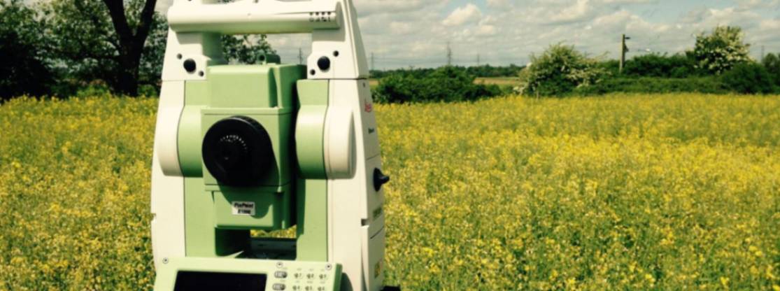
- Millimetre-Accurate Site Mapping – Capturing the exact coordinates of contested perimeter features like walls, hedges, and fences.
- Encroachment Auditing – Identifying where neighbouring structures or eaves overlap into the registered land area.
- Expert Witness Reporting – Producing CPR-compliant documentation that is suitable for use in high-court or tribunal proceedings.
- Physical Boundary Demarcation – Installing permanent pins or markers to provide visible evidence of the surveyed property limits.
Why Should You Choose Professional Boundary Dispute Survey Services?
Choosing professional experts for a boundary dispute survey ensures that your case is built upon a foundation of absolute technical integrity and geospatial accuracy. Professionals use regularly calibrated instrumentation and hold specific indemnity coverages that unvetted providers lack, which minimises the risk of miscalculating structural clearances or land area.
This expert oversight maximises project efficiency, providing a clear audit trail and protecting your investment from the financial fallout of mapping errors.
How Much Does a Boundary Dispute Survey Cost?
The cost of a boundary dispute survey ranges from £800 to over £4,500, depending on the acreage of the site, the complexity of the title history, and whether expert witness reporting is required.
Costs are primarily influenced by the amount of historical deed research necessary to reconcile conflicting plans, the time spent on-site for millimetre-accurate data capture, and the production of CPR Part 35 compliant reports.
Contact Boundary Dispute Survey to get customised prices for a boundary dispute survey at your property.
Get a Free No Obligation Quotation Today
Where Are Boundary Dispute Surveys Required Across Disputed Properties?
Professional investigations by a boundary dispute survey are required wherever a disagreement over the physical extent of ownership threatens property value or development progress. The service is critical for residential gardens, large commercial estates, and agricultural land divisions where historic markers have been lost or moved.
By mapping these contested zones, we provide the indisputable geospatial evidence required to resolve conflicts, ensuring that land transfers and extensions can proceed without legal hindrance.
When Should You Carry Out a Boundary Dispute Survey?
You should carry out a boundary dispute survey as soon as either party identifies a disagreement regarding a fence line or wall position. Taking action before any permanent construction work begins ensures that you do not inherit a legal liability or build over a neighbour's line.
Engaging our team during the initial dispute phase prevents the escalation of costs, providing the insurance-backed technical data needed to facilitate an amicable settlement or a successful legal outcome.
How Does the Boundary Dispute Survey Process Work?
The operational workflow for a boundary dispute survey involves a sequence of meticulous research, field data capture, and comparative analysis to ensure technical integrity. We begin by reviewing Land Registry title deeds and then establish geodetic control points on-site to calibrate our measurements with the national grid.
This process ensures that every finding is triangulated with absolute accuracy, resulting in a verifiable dataset that allows legal teams to verify title absolute status with total confidence.
What Evidence and Information Are Provided in a Boundary Dispute Survey?
When conducting a boundary dispute survey, our geomatic engineers provide several critical layers of information to support your legal position:
- Geospatial Positioning Data – Recording the exact coordinates of every disputed point relative to the Ordnance Survey.
- Comparative Deed Analysis – Mapping existing physical features against historical deed dimensions and Land Registry plans.
- Overlap Identification – Documenting the precise area of unauthorised land use or structural encroachment.
- Scaled Technical Drawings – Producing layered CAD plans that clearly illustrate the relationship between physical and legal boundaries.
- Formal Expert Report – Delivering a professional summary of findings that is defensible under cross-examination in court.
Which Property Owners and Legal Cases Require Boundary Dispute Surveys?
A diverse range of stakeholders rely on a boundary dispute survey to manage the financial and legal risks of contested land, including homeowners and developers. Solicitors and legal professionals use the data to formulate mediation strategies, while local authorities require surveys for public infrastructure ownership queries.
These sectors choose professional evidence to mitigate their legal responsibilities, ensuring that even unauthorised trespassers or encroaching structures are dealt with using accurate spatial facts.
How Quickly Can a Boundary Dispute Survey Be Completed?
A technical field investigation for a boundary dispute survey can typically be completed within one to three days, depending on the scale of the dispute. Following the site visit, the digital processing and reporting phase takes additional time to ensure that all historical research is correctly integrated.
This efficiency ensures your legal or construction schedule remains on track, providing you with the high-resolution reports needed to advance the case without unnecessary administrative delays.
What Legal Standards and Regulations Apply to Boundary Dispute Surveys?
Every inspection conducted by a boundary dispute survey adheres to the rigorous RICS Professional Statement for land measurement and UK property law requirements. We ensure all reports comply with Civil Procedure Rules (CPR) where litigation is imminent, providing a defensible audit trail of evidence.
Adhering to these UK standards ensures the delivery of legally compliant outputs, providing the insurance-backed certainty that lenders and courts demand when resolving high-value land investments.
Contact Boundary Dispute Survey for a consultation to get a boundary dispute survey tailored to your organisation’s risks and responsibilities.
Request a free quote
What People are Saying About Us
★★★★★
"We needed an independent survey to resolve a boundary dispute with our neighbour. The report was detailed, professional and provided the evidence needed to reach an agreement."
Zoe Winterbourne
London
★★★★★
"The surveyor clearly explained the boundary position and supplied accurate plans that helped settle a long-running dispute."
Brandon Tinsley
London
★★★★★
"Excellent service from start to finish. The survey findings were presented clearly and proved invaluable during discussions with adjoining property owners."
Dominic Henshaw
London
★★★★★
"Professional, impartial and highly knowledgeable. The boundary survey gave us confidence in our position and helped avoid legal action."
Finlay Cartwright
London
Our Locations
We are proud to work nationally across the UK, allowing us to ensure we can provide services to you.
For a full list of counties we cover in the UK, see below.